DN1–DN12, DN14 · South Yorkshire
Surveyors in Doncaster. Read before you buy.
Railway town, coalfield villages, low-lying land — three histories in one patch.
We aim to reply within one working day.
- Room over
- Shared passage
- Shared drain
- Flood bank
- Coverage
- DN1–DN12, DN14
- Surveys
- Level 1 · 2 · 3
- Fixed fees
- Level 2 from £335 Level 3 from £570
- Regulated
- RICS firm no. 9317773
Independent building surveyors providing RICS Home Survey Level 2 (formerly the HomeBuyer Report) and Level 3 reports across Bessacarr, Wheatley, Bentley, Armthorpe and the wider DN1–DN12, DN14 area, from Mills Building Consultancy, based in Huddersfield, West Yorkshire.
The local housing stock
Houses in Doncaster: what they are and how they behave.
01The housing stock
DN1–DN12, DN14+
Doncaster’s stock tells three stories: railway-era brick terraces around the city centre and Hexthorpe, colliery villages like Bentley, Armthorpe and Edlington built in planned rows, and a wide spread of interwar semis through Wheatley and Bessacarr out to modern estates. Tickhill and Conisbrough add older market-town and stone stock.
02What this stock typically shows
Common defects+
The land is the local variable: much of the borough is low-lying, and areas like Bentley and Thorne carry a real flood history that searches and insurance quotes must confirm. Worked coal sits under the colliery villages, so movement gets read against ground history. The brick terraces bring standard solid-wall behaviour; the planned colliery rows often share structures and alterations.
03Which survey level — honestly
Level 2 vs 3+
Victorian terraces, colliery rows with movement history, and anything older in Tickhill or Conisbrough justify a Level 3. Doncaster’s large interwar and modern stock is usually well served by a Level 2. Full scope of each level: Level 2 survey and Level 3 survey. Or start with which level do you need?
Not sure which level fits? Send the address or the listing and we will confirm the right level, and a fixed fee for that house, before you commit.
From the survey archive
Walls, drainage and the roof space.
A bay meeting the main wall at paving level, a hole in a waste-pipe bend, leaves covering a gully and torn roof underlay, from our survey archive. These are examples from our wider survey work, not photographs of a property in Doncaster.
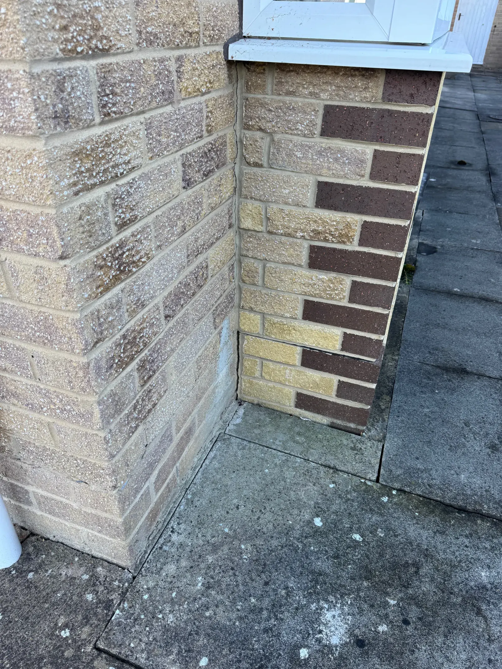
Bay-to-wall junction at paving level
A narrow gap at the lower junction between the bay, main wall and paving.
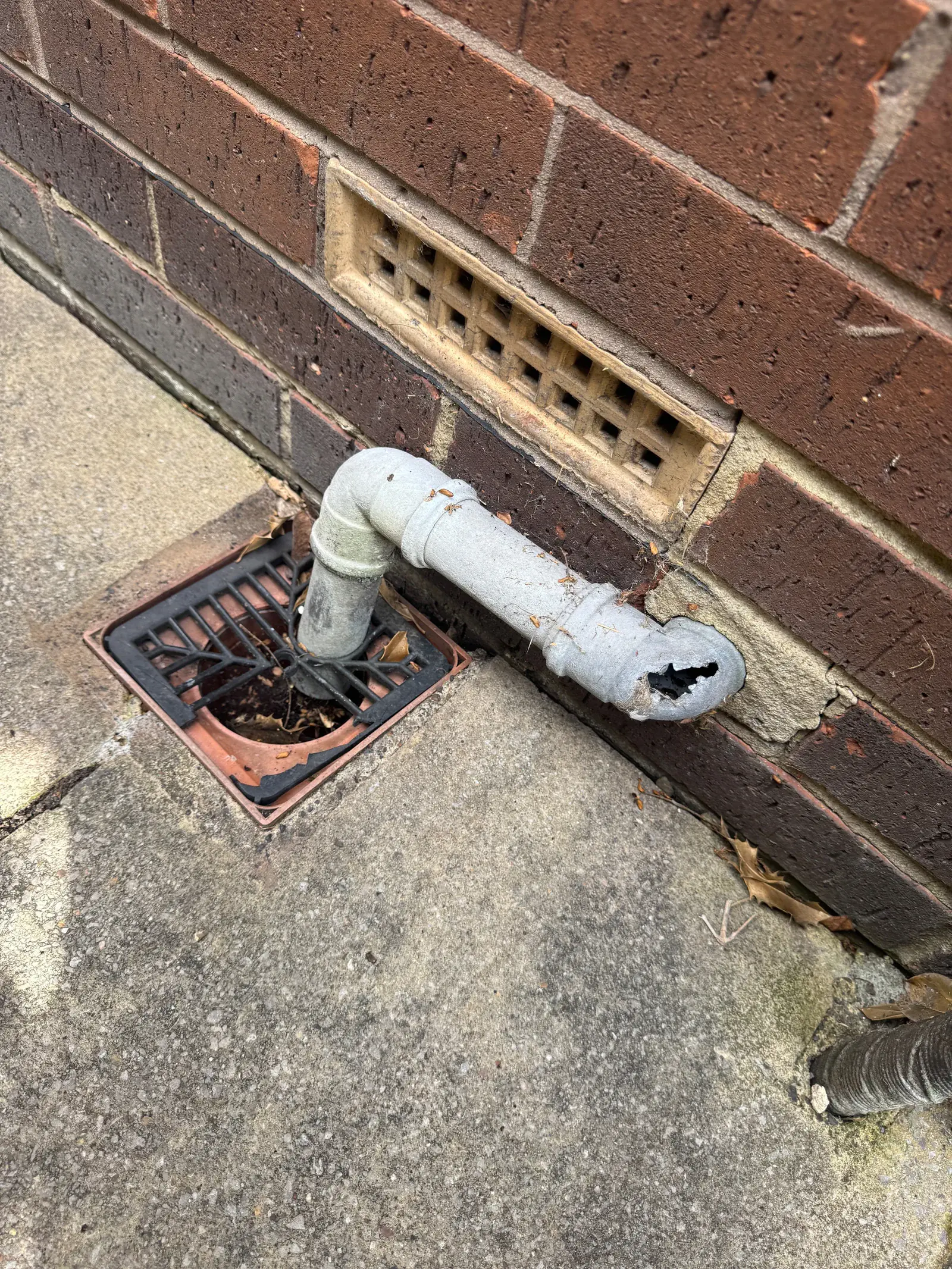
Hole in a waste-pipe bend
A hole in the white waste-pipe bend above a gully beside an air brick.
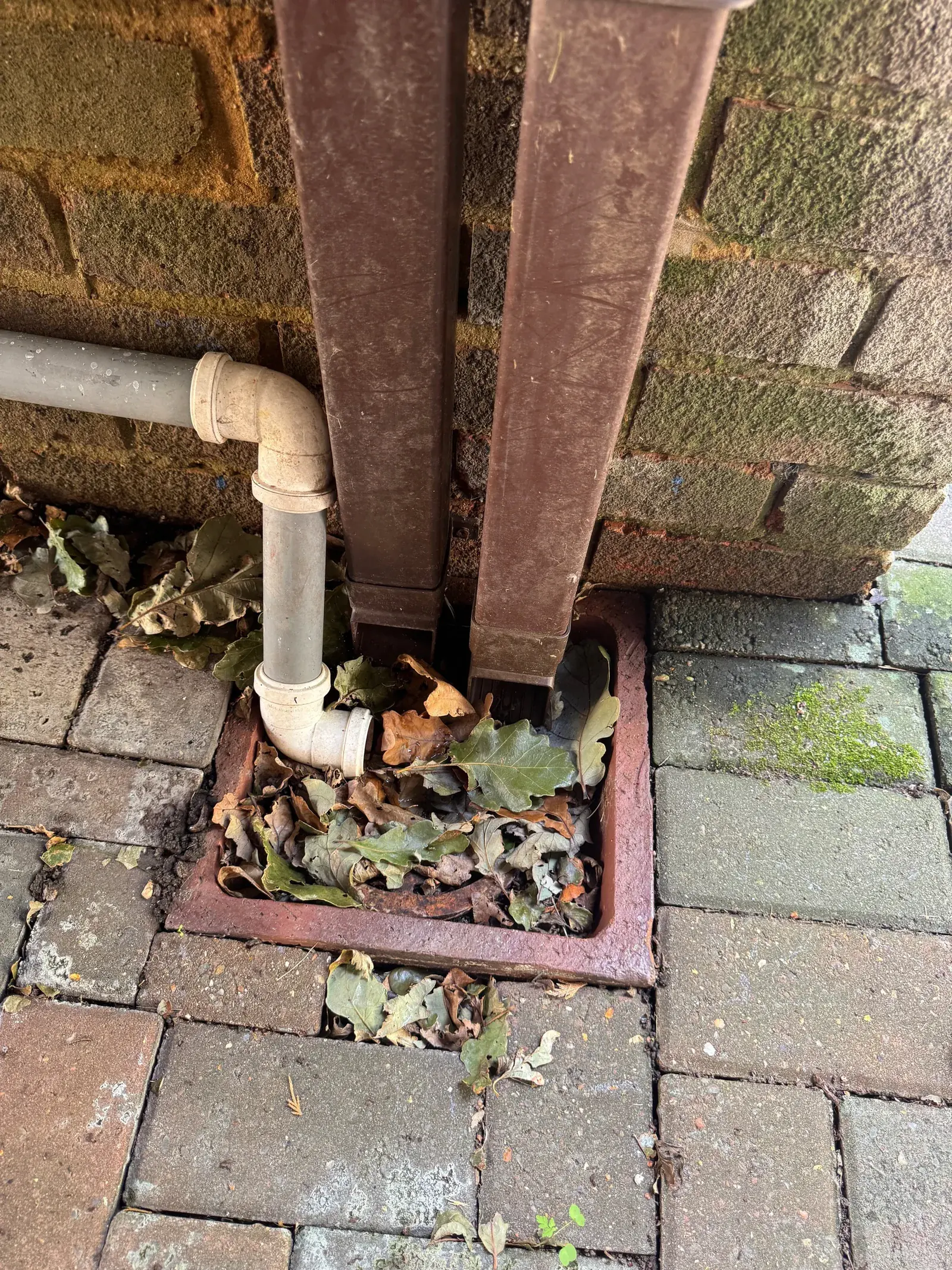
Leaves covering a gully
Leaves and debris covering the gully beneath rainwater and waste pipes.
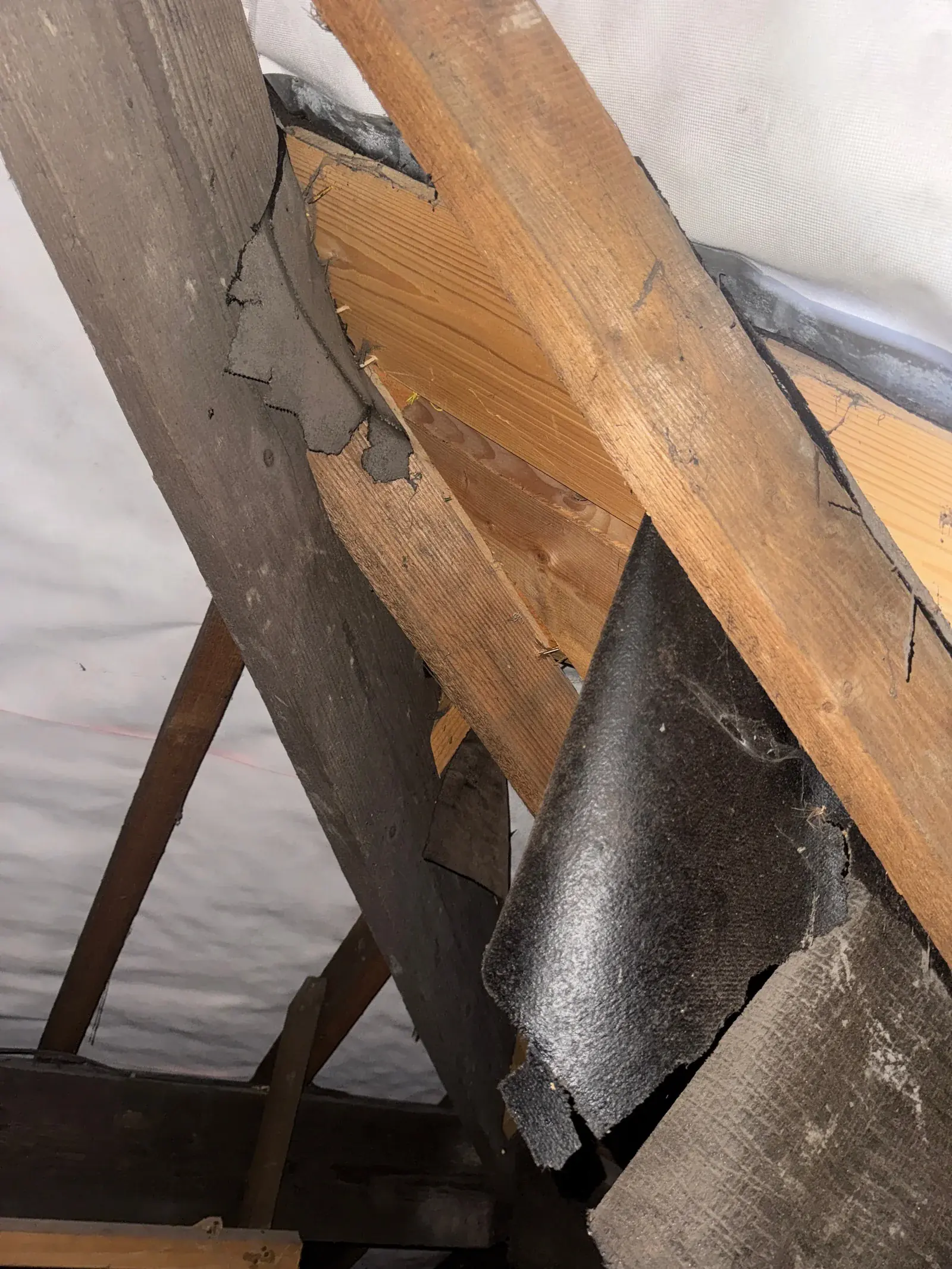
Torn roof underlay
Torn roof underlay hanging loose between the timbers.
Photographs from our survey archive.
Explore the full photograph collectionWho does the work
We handle every survey ourselves. Mills Building Consultancy is an RICS-regulated firm (no. 9317773). Our surveyors are qualified professionals: members of the Royal Institution of Chartered Surveyors (RICS) and the Chartered Institute of Building (CIOB), and our damp and timber surveys are carried out by a PCA Qualified Technician (Damp and Timber Buildings). Complaints have independent redress through The Property Ombudsman. No call centres and no lead-selling: your survey stays with us.
Common questions · Doncaster
Asked before booking.
How much does a house survey cost in Doncaster?
A Level 2 survey starts from £335 and a Level 3 survey from £570. The fee is fixed by three things only: the purchase-price band, the property type and whether the home has four or more bedrooms. A house in Bentley or Thorne, where the flood history is real, costs no more to survey; the flood risk itself is confirmed through your conveyancer’s searches and your insurer. Age, construction and condition change which level we recommend, not the fee. The survey cost calculator shows the fee for your property in seconds, and we confirm it in writing before you commit.
Is flooding a concern for Doncaster property purchases?
In parts of the borough, genuinely — Bentley and Thorne in particular have real flood history. That comes through your conveyancer’s environmental search and your insurer; the survey reads what the building shows and flags anything that makes those checks worth reading closely.
Do you survey the planned colliery rows in Bentley, Armthorpe and Edlington?
Yes, and they need reading as rows rather than as single houses. The planned colliery rows often share structures and have been altered over the years, and worked coal sits under the colliery villages, so movement is read against the ground history alongside your conveyancer’s coal-mining search. Where there is movement history, a Level 3 is the right survey.
Do you cover the villages around Doncaster?
Yes — DN1 to DN12, from the city through Bessacarr, Bentley, Armthorpe, Conisbrough and Thorne to Tickhill, plus Mexborough (S64) and Goole (DN14).
House survey cost calculator What a house survey costs See a sample report Request a quote
Local reading · Doncaster
Guides for buyers in Doncaster.
Matched to the kind of houses you’ll be viewing in Doncaster — what to look for, and what to ask.
- Signs of subsidence: what it is, what causes it, and how to check your house
- How to check flood risk before buying a house
- Horizontal, vertical and diagonal cracks in walls: what each one means
- Snagging surveys: what new-build buyers need to know
- Chimney breast removal: what buyers and owners need to check
- Ten questions to ask before you offer on a house
- House viewing checklist — print it or tick it off on your phone.
- How old is my house? — date a house in Doncaster from its walls, windows and roof.
- Japanese knotweed identification — check a suspect plant in the garden or next door.
Before you buy in Doncaster
Five official checks worth doing.
Alongside the survey and your conveyancer’s searches, these official sources tell you a lot about a property in Doncaster in minutes:
- Check long-term flood risk — the Environment Agency’s map of flood risk from rivers, surface water and more (GOV.UK).
- Radon maps — UKHSA’s check on whether the area is affected by radon, a natural gas from the ground.
- Coal mining information — the Mining Remediation Authority (formerly the Coal Authority), for property in former mining areas.
- Find an energy certificate — the property’s EPC rating and recommended improvements (GOV.UK).
- Search the listed buildings register — whether the property or its neighbours are listed (Historic England).
It’s also worth checking the council’s planning records for past extensions and alterations. Here they’re held by City of Doncaster Council. Those records tell you what’s been approved; the survey tells you what they can’t — the actual condition of the building.
Coal mining and the mining report
Doncaster lies on the eastern, concealed part of the Yorkshire Coalfield, where the coal is buried beneath younger rock. Not every street was undermined, and most cracking in older houses has ordinary causes, but a recorded mine shaft or shallow workings nearby change what a crack or a sloping floor means. Start with the free postcode check from the Mining Remediation Authority (formerly the Coal Authority), the coal mining link in these checks. If the property is in a coal mining reporting area, your conveyancer can order a coal mining report (often called a CON29M): it interprets the official records for that address, including past, present and future underground and opencast coal mining, recorded mine entries such as shafts, and past coal mining subsidence claims. The survey then reads any movement in the building against what the report shows.
Buying in Doncaster?
Know the building first.
Fixed fee for the specific property, quoted before you commit. Tell us the address and your timescale — we will confirm the right survey level and the earliest inspection date.
Level 2 from £335 · Level 3 from £570
We aim to reply within one working day.
- RICS-regulated firm no. 9317773
- The Property Ombudsman
- Professional indemnity insured
- Read our reviews on Google