Independent building advice · Huddersfield, West Yorkshire
Drone survey services
Roofs and high-level building elements are where many serious defects start — and where traditional inspection from ground level with binoculars falls short.
The scope and fee are agreed before you commit.
- Valley gutter
- Chimney flashings
- Capture footprint
- Pilot in line of sight
01 / Your situation
When drone inspection helps
Scaffolding or access equipment purely for inspection is often disproportionate.
Drone inspection closes that gap. It captures high-resolution aerial images of roof coverings, chimneys, flashings, gutters and facades, safely and quickly. They feed directly into survey reports, defect investigations and insurance claims documentation.
Mills Building Consultancy is registered with the Civil Aviation Authority as a drone operator, its pilot holds a CAA Flyer ID, and commercial drone insurance is in place.
UK drone rules are set by risk rather than by whether the work is paid for. Inspection flights are usually planned in the CAA’s Open category, which has three subcategories: over people, near people and far from people. Which one a flight can use depends on the drone’s class mark or weight, the pilot’s qualifications and how close it has to come to people and buildings. Every site is checked against those rules before a flight is confirmed.
- Roof condition assessment as part of a home survey or defects investigation
- Inspection after storm damage for insurance claims evidence
- High-level elements — chimneys, parapets, valley gutters — that cannot be seen from the ground
- Documentation of large or complex roofs, and properties where access equipment is impractical
- Progress or condition records for building consultancy work
What you get
- High-resolution stills and video of roofs, chimneys and facades
- A photographic record annotated with observations and defect locations
- Integration with survey and claims reports, or standalone aerial documentation
- Flights by a registered CAA operator and a pilot holding a CAA Flyer ID, with commercial drone insurance in place
Operational limits
- Flights stay within the CAA Open category limits: no higher than 120 metres from the ground, within the pilot’s direct sight and never over crowds. They also keep the distances from uninvolved people that the drone’s class and subcategory require. A flight that could only be made outside those limits needs a CAA operational authorisation in the Specific category. If a site falls into that bracket, we tell you at enquiry stage, and we do not fly it on that basis unless the right authorisation is in place
- Flights are planned to avoid passing over people who are not involved. The camera is kept on the property being inspected, so images of neighbouring homes and gardens are limited to what the inspection needs
- Weather-dependent: high winds or rain can require rescheduling
- Drone imagery supplements, and does not replace, hands-on inspection where touch and testing are needed
From the survey archive
Roof details worth a closer look.
Roof slopes and a valley seen from above, vent pipes on a tiled roof, damaged corrugated sheeting, cracked chimney flaunching, water and debris in a slate-roof gutter and vegetation in a narrow roof channel, from our survey archive. They were taken during our wider survey work, not recorded as drone captures, and show the kind of detail an aerial inspection is commissioned to see.
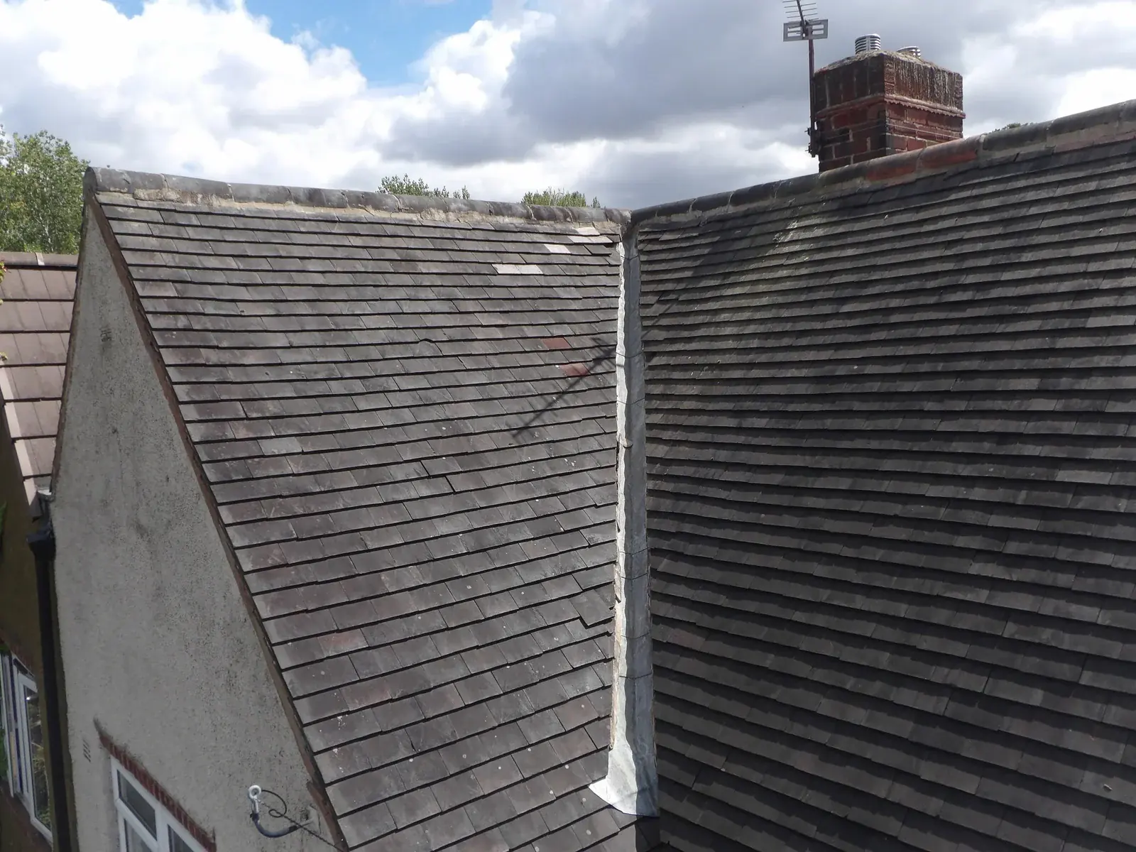
Roof slopes, valley and chimney
Two roof slopes meeting at a valley beneath ridge tiles and a chimney.
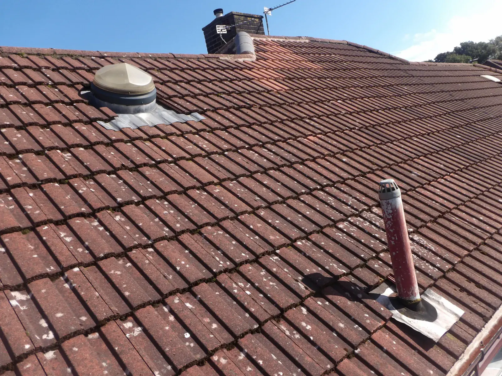
Vent pipes and flashings on a tiled roof
Vent pipes and flashings through a tiled roof slope.
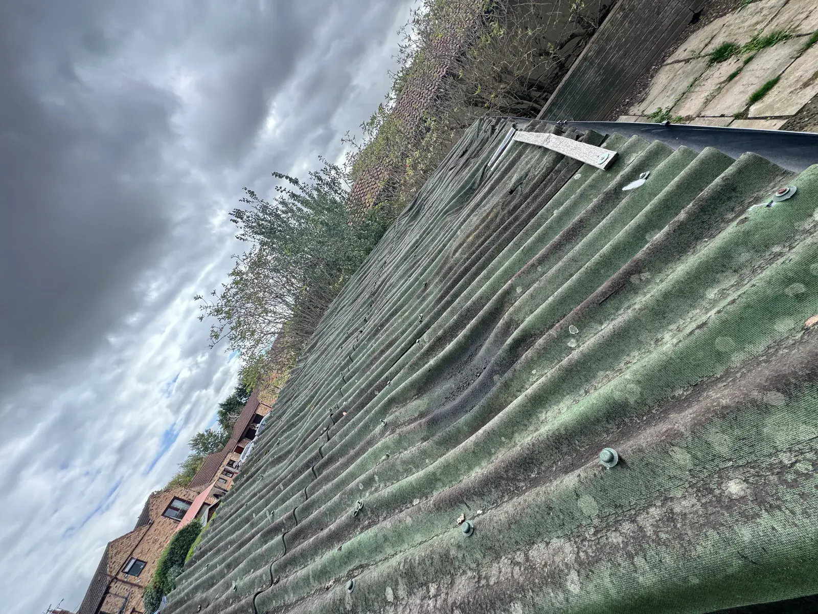
Damaged corrugated roof sheets
Distorted and damaged corrugated roof sheets.
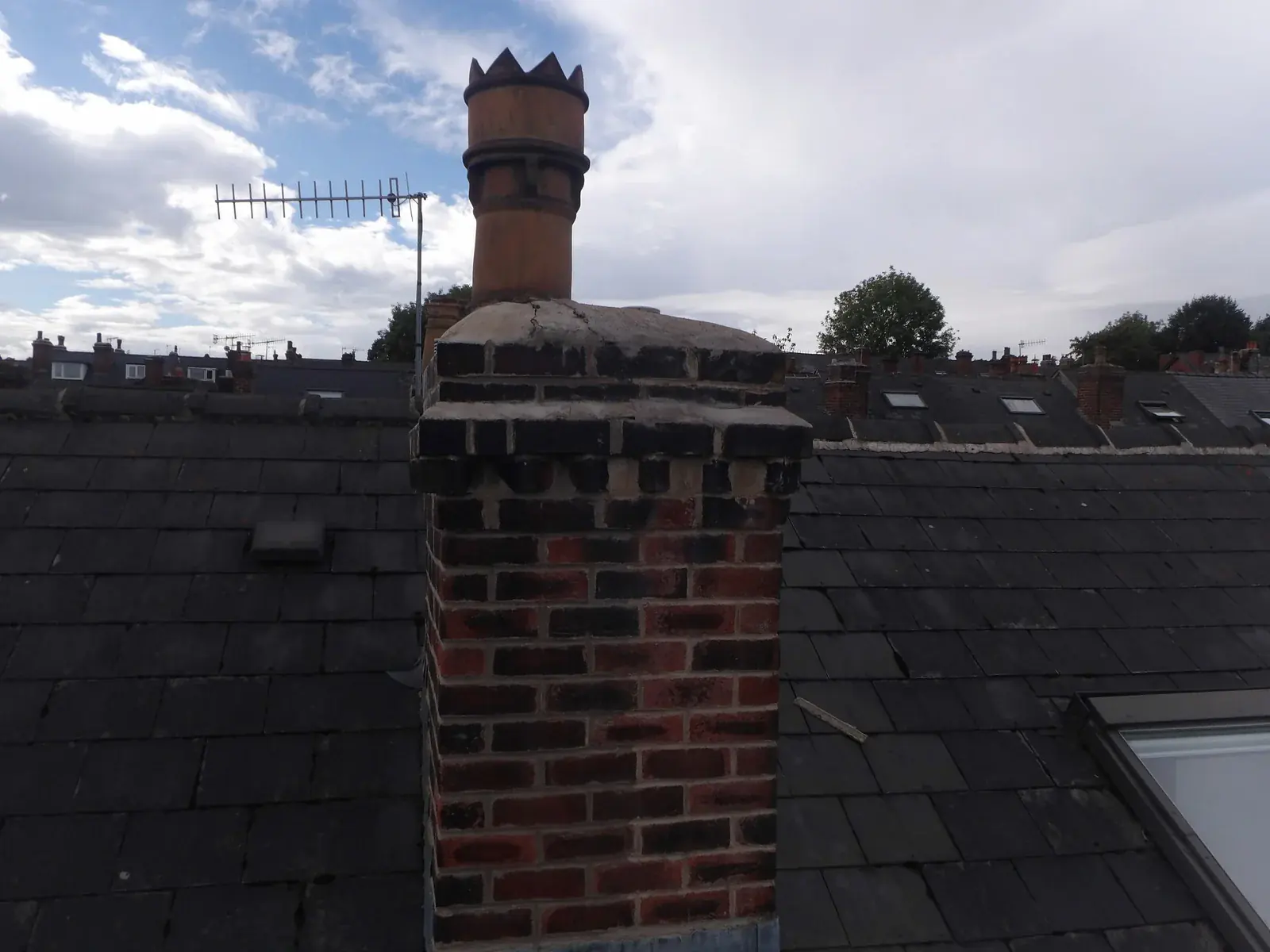
Cracked chimney flaunching
Cracked flaunching around the chimney pot.
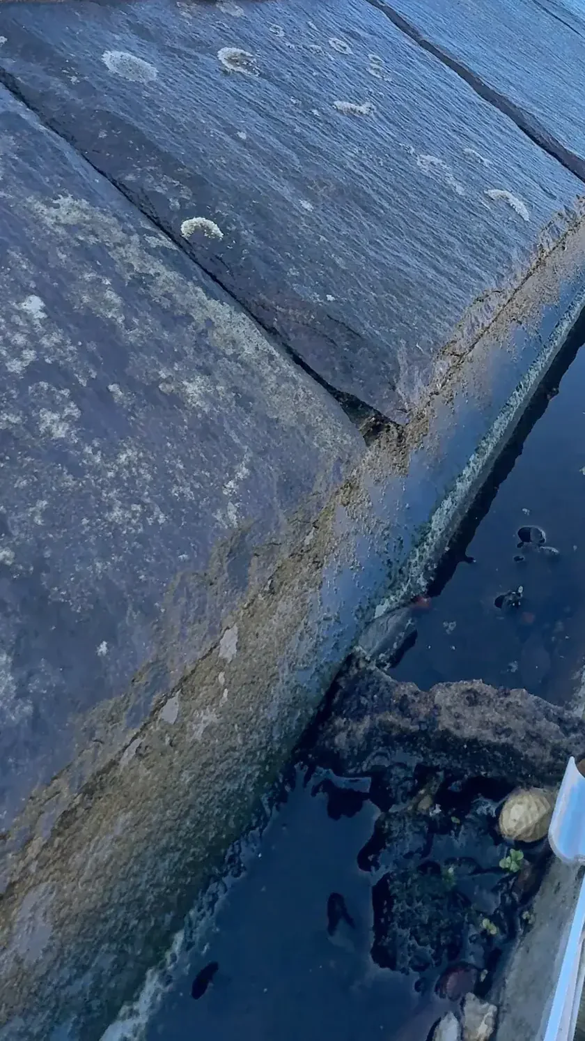
Water and debris in a slate-roof gutter
Water and debris in the gutter beneath the slate eaves.
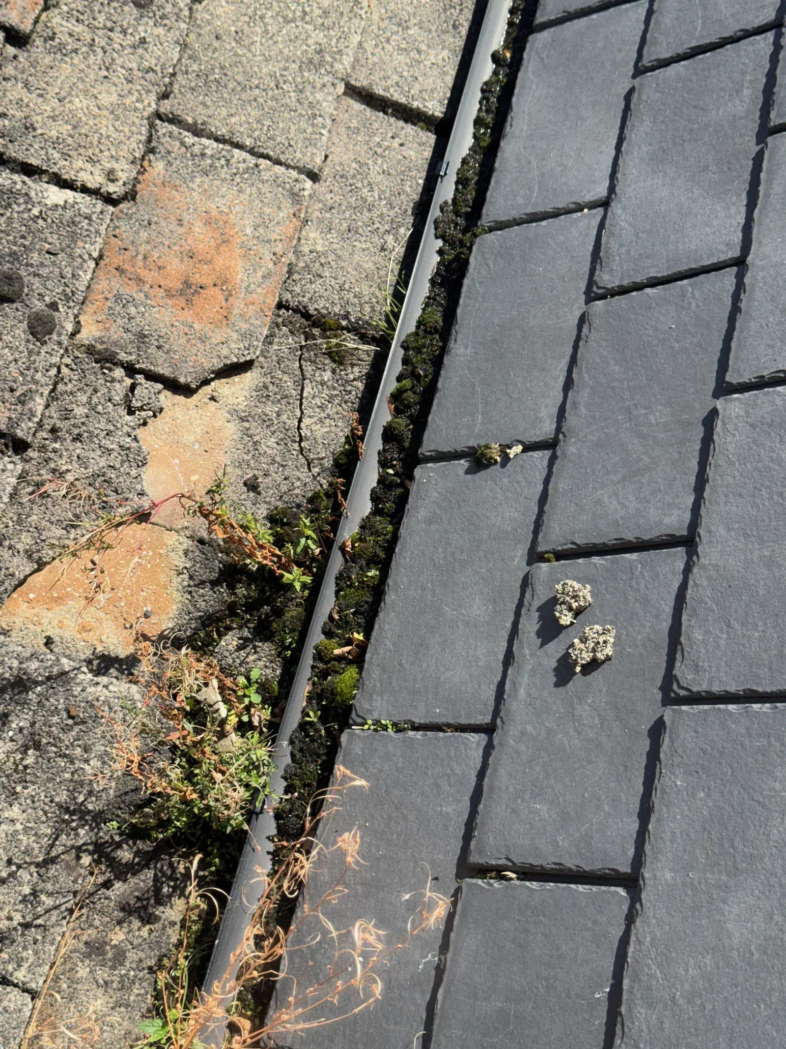
Vegetation in a narrow roof channel
Moss, leaves and plants in the narrow channel between two roof coverings.
Photographs from our survey archive.
Explore the full photograph collectionOur approach / Evidence before conclusions
How it works
- 01
Feasibility check
The location is checked against airspace restrictions, the nearest people, roads and buildings, and the Open category subcategory the flight would need, before the flight is confirmed.
- 02
Flight
A planned inspection flight capturing systematic coverage of the roof or facade — typically under an hour on site.
- 03
Deliverables
Annotated imagery and observations, either as a standalone record or integrated into a wider survey or claims report.
The flight is designed around fabric, access and airspace.
Overlapping imagery creates useful, traceable coverage.
Findings are located precisely for action on the ground.
Before you decide
A clearer brief.
A useful answer.
Tell us what you have noticed, what has already been checked and what decision you need to make. We’ll confirm where we can help.
Discuss your propertyAre you licensed to fly commercially?
There is no separate commercial drone licence in the UK: the rules depend on the risk of the flight, not on whether it is paid for. Anyone operating a drone of 100g or more with a camera, or of 250g or more, must register with the CAA for an Operator ID, and anyone flying a drone of 100g or more needs a Flyer ID, which means passing the CAA’s online theory test. Mills Building Consultancy is a registered operator, its pilot holds a Flyer ID, and it carries commercial drone insurance. Flying closer to people with a heavier drone needs more: the A2 Certificate of Competency for the near-people subcategory, or a CAA operational authorisation in the Specific category. Where a site would need either, that is identified at feasibility stage.
Can you fly anywhere?
No. Airspace restrictions and flight restriction zones around airports apply, and in the Open category a drone must stay within 120 metres of the ground and within the pilot’s sight, must never be flown over crowds, and must keep the distances from uninvolved people that its class requires. In the far-from-people subcategory that means at least 150 metres from residential, commercial, industrial and recreational areas, so a house in a built-up street can only be flown in the over-people or near-people subcategories, with a drone and pilot qualified for them, or under a Specific category authorisation. Every job starts with a feasibility check, and you will be told plainly if a site cannot be flown compliantly.
Is drone inspection as good as getting on the roof?
For visual condition assessment it is often better: full coverage, high resolution, and nobody has to climb onto the roof. What it cannot do is touch, lift or test. The report is always clear about what aerial imagery can and cannot establish.
Can drone imagery be used in my insurance claim?
Yes — dated, high-resolution aerial documentation is strong evidence of storm damage and pre/post-repair condition, and integrates directly with the insurance claims consultancy service.
Follow the detail
Keep exploring.
The standards behind this service
- Flyer IDs and operator IDs
The Civil Aviation Authority’s rules on flyer and operator IDs for drone operation in the UK.
- Where you can fly
Height limits, flight restriction zones and the distances from people and buildings in the Open category.
- Class marks
How a drone’s UK class mark decides which Open category subcategory it can fly in.
- Specific category overview
When a flight falls outside the Open category and needs a CAA operational authorisation.
Roof out of sight?
See the roof from every side.
Send the property address and explain the situation. We’ll confirm the appropriate scope, fee and next step.
Request a drone survey quoteOr call 01484 218579We aim to reply within one working day.